
Village of the Koguis
(Sierra Nevada de Santa Marta, Colombia)
"Your Spanish isn't good, so I can't permit you to go any further," said the deputy chief of super twink on the back of a white horse. (In a primitive society, the prominence of appearance and body must be a special gift for those who lead everyone). It was the morning on the 4th day. The night before, I was told that the deputy chief had a story, so I arranged a sentence to convey my hope, but I didn't have time to reply to him. Soon he ran away. It didn't matter what the reason was.
I was in the Koguis village, Tabiaca, on the northern slopes of the Sierra Nevada de Santa Malta Mountains, in northern Colombia. It was the first village after a 1.5-day walk from the mountain foot and a 7-hour walk from the last pioneer's house, walking up and down the mountain path. On the way, there was no village except that I saw a solitary house over the mountain several times. Beyond the wooden bridge over the clear stream was a village that has been cleared of forest and turned into grassland. The circular huts for locals, which wall was made of bamboo and finished with soil and which roof was covered with straw, are densely packed at random.
In the Arhuacos' village on the other side of the mountains, stone walls separated the inside and outside of the village. Inside the stone walls, the houses with rectangular floor plan were arranged in rows. Meanwhile, in the Koguis' village, the boundaries between the grassland and the surrounding forest were ambiguous, and the lay-out of circular houses were without clear rules. It's interesting that there are so many differences in the same mountains. That showed the differences in the world views between two tribes.
From there, I planned to follow to the innermost Kogi village, San Miguel, or San Francisco via the villages that were supposed to be scattered in the steep mountains. I stayed there to get permission to go forward from the executor of Tabiaka, half imprisoned except a short walk to a nearby village、San Antonio. And, that morning the possibility of exploration was gone.
On the 1st day, the Koguis men took me to witness a prayer around a rock on the border between the village and the forest, but that communication disappeared day by day. The number of adults, who approached, had decreased, and the children, who are usually the start for interaction, didn't respond. Invisible instructions covered the village. I decided to go away and put origamis as a gift outside the hut I stayed in. For a while, torn origamis were thrown into the hut, and children ran away. It was their answer.
"Closed community" was a faint scream, will, and power. Near Tabiaka was a small school, and I heard salsa at a faint sound from a hut in the village. Apart from their traditional shifting cultivation, Coffee beans cultivated around the village were transported to the civilized society at the foot of the mountain as cash crops. Seven hours of distance, traditional life, and a stubborn attitude were their way against the civilization. Shortly before I visited, the BBC had visited to film, but they are said to have not enabled to get permission to go to a innermost village.
"Beyond this river is the land of Indigena," said Ricardo, an indigenous blood guide. It was on the outbound route to Tabiaka. Under high treetops, the ground was covered with undergrowth, and a stream crosses dense forest. It was a clear flow. The width of the river was very narrow and very wide. That was in 1991.
In 2008, the government built an emergency road from the mountain foot to the school as a contact point. It was for the education and vaccination of children. Beyond here, only a mountain path continues. Looking at Google Maps, the village that was located near the end of the road and where I was imprisoned disappeared unexpectedly.
(Note) In the Spanish-speaking countries of South America, indio is not used as a discriminatory term, but indigena, which means indigenous people, is used.
Google Maps (San Antonio village)
Transportation
2 hour by bus from Santa Marta to Mingueo. 12 hours by walk from Mingueo to the fist village of Kogui Tribe, or 1hours by car possible to drive a rough road and 7 hours by walk to the fist village of Kogui Tribe.
Since the area of Kogui Tribe is protected, a visitor has to get a permission from Inderena (Administration Bureau for the indigenous people). In order to get a permission, a guide with a licence of Colombia goverment is required. Moreover, within the area of Kogui trive, the permission from the chief is also necessary to walk around.
Link
Accommodations
References
"Dumingueka es el nuevo pueblo de los Kogui" (El tiempo 2008/07/18)
"旅のチカラ"(石井大五,新建築住宅特集2006年1月号,新建築社)
Upload
2008.08 Photos in English version, and photos and text in Japanese version
Update
2018.01 Change of photos and English text
2022.07 Change of photos and Japanese and English text
Copyright (C) Future-scape Architects. All Rights Reserved.
無断転載は、ご遠慮いただくようにお願いいたします。
Village of the Koguis : See San Antonio, the neighboring village of Tabiaka where I stayed, from the top of the hill.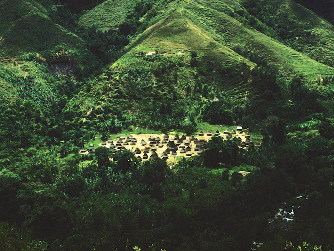
Village of Koguis : See Tabiaka village where I stayed. Grasslands spread around the village. The white pillar on the front is the gate to the village. Smoke of shifting cultivation rises on the slopes of distant mountains.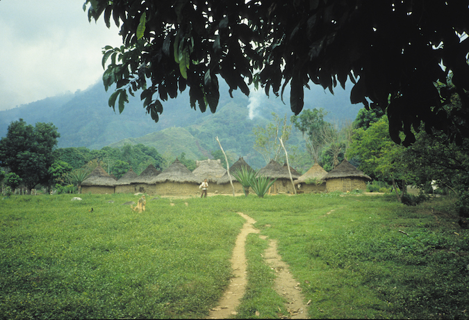
Village of Koguis : The scenery of the village Tabiaka where I stayed. The white pillar on the left is the gate to the village.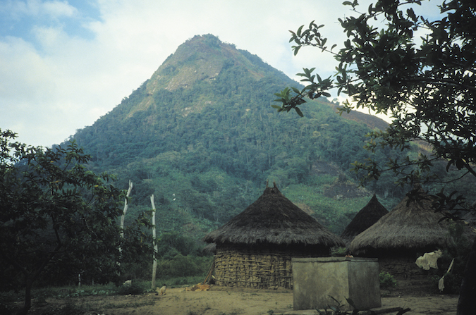
Village of Koguis : The scenery of the village Tabiaka where I stayed.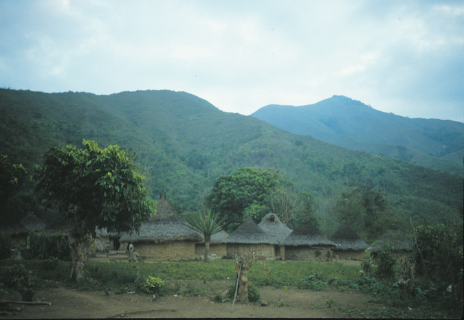
Village of Koguis : The scenery of Tabiaka village. The square hut was a storage, and it was provided as a place to stay. The large circular hut behind it is a ritual facility, and the sound of magical prayer was sometimes leaked from it.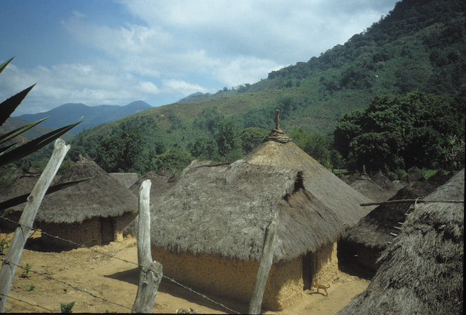
Village of Koguis : The scenery of Tabiaka village.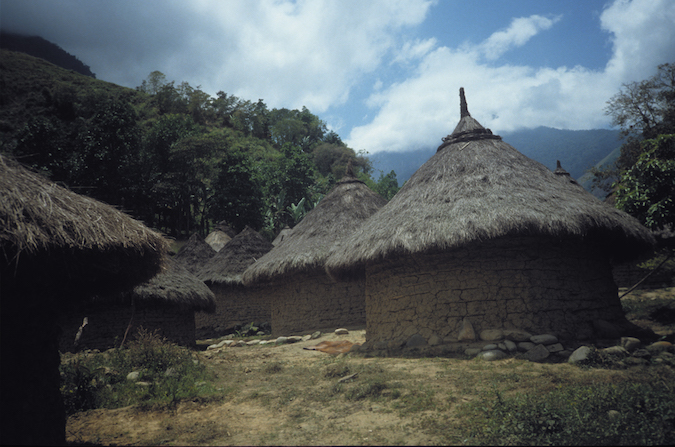
Village of Koguis : (left) See a local resident's house. (right) Rocks were buried in a bush at the end of the grassland of the village. It was a holy place where the Koguis of Tabiaka prayed. Immediately after arriving in Tabiaka, they took me here, and prayed together, kneeling and prostrating.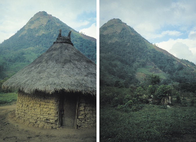
The scenery of Tabiaka village in the morning.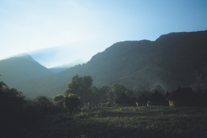
Village of Koguis : A bridge that crossed a clear stream. It was the entrance to Tabiaka, and was a short walk from the village.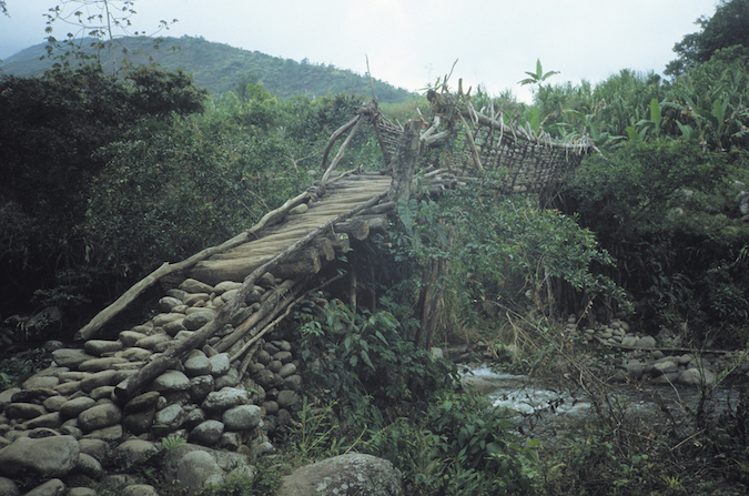
Village of Koguis : See San Antonio, the neighboring village of Tabiaka where I stayed, from the top of the hill.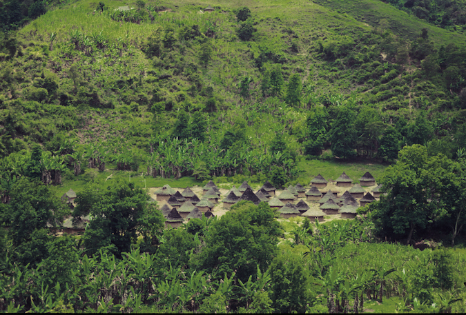
Village of Koguis : The scenery of San Antonio village. The circular building is a residence. The square hipped roof is a ritual facility or a storage. The village had an open impression compared to Tabiaka.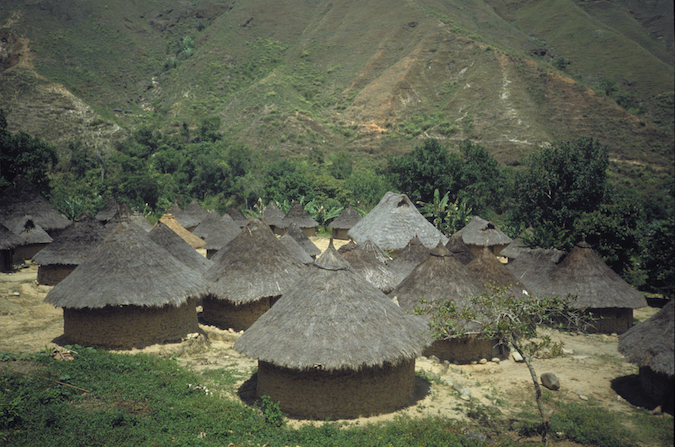
Photo by Daigo Ishii