
Village in Amami Islands:Yorojima Island - 1 : Yorojima Island Route
(Setouchi, Amami Islands, Kagoshima, Japan)
In Koniya Port in Amami Oshima Island at 9:30 am on July 27, the sky was clear, the wind didn't move, and the sunshine like daytime was already strong. A ferry bound for Yorojima Island was anchored at the wharf, which was exposed to the sun and became a heat pool. The characters of Setonami were written on the small hull.
It takes less than 2 hours by ferry once a day from Koniya Port at the southern end of Amami Oshima Island to Yorishima Island. It is a place like a remote island for a remote island. Kakeromajima Island faces Koniya Port across the Oshima Strait that stretches from east to west, and, beyond Kakerohima Island, Ukejima Island and Yorojima Island are close to each other across the Ukejima Channel. It is a sea route with many cancellations because it goes out into the open ocean of the Pacific Ocean.
20 years ago, I waited for the ferry for three days, but in the end, the ferry did not leave due to a typhoon and I gave up going to Yorojima Island. This time, it was also a season when typhoons hit once a week, but the next typhoon happened to be stagnant, so it was a calm day for navigation.
The ship weighs 85 tons and has a capacity of 60 people. The ferry from Amami Oshima Island to Tokunoshima Island, passing west of Yorojima Island, has a maximum capacity of 8000 tons and seats 700 people, so the ship for Yorishima Island is quite small. The luggage space as the lifeline of remote islands occupied half, and the cabin and deck were compact. The cabin was dark since the curtains were shut to avoid strong sunlight, and the air conditioner was too cold. Most of the 30 passengers were already sleeping with blankets before departure.
At 10:00 am, the ship left port at Koniya. It slowly advanced through the green landscape, with Amami Oshima Island on the left and Kakeromajima island on the right. A strait with close both banks seemed to be a calm estuary. But, according to the steep Amami terrain continuing deep into the sea, the color of the water was already dyed in the deep indigo of the open ocean.
15 minutes later, the ship ran out into the Pacific and turned south. The waves were getting rougher and sometimes the ship weltered heavily on big waves. The combination of a small ship that was tossed by the waves and the more dyed and deeper sea stirred anxiety. The backside scenery of Kakeromajima Island also switched to rugged, rocky, wave-eroded masculine cliffs. Eventually, the ship turned west and entered the Ukejima Channel, and Ukejima and Yorojima appeared in sight. Today, Tokunoshima island was also seen hazily over there. Seeing the end of the route, my anxiety was alleviated.
45 minutes after the departure, the first port of call, Ukeamuro Port on Ukejina Island, was approaching. The bottomless indigo sea suddenly turned into a beautiful cobalt blue, and the ship slid into the calm coral reef. The village was hidden in the trees. Several pick-up cars parked at the wharf, and 21 people, who were most of the passengers, disembarked. The population of Ukejima Island is a little over 100, which is a little larger than that of Yorojima Island. The sailors wondered, "Why do the passengers disembark so large today?"
The ship arrived at the next port of call, Ikeji Port on the same island, 10 minutes later. The village at the back of the wharf was also covered with trees, and the roof could only be seen faintly. When five people got off, there were only five passengers left, and the inside of the ship suddenly became quiet.
Leaving Ukejima Island, the sea returned to a deep indigo color. In front of Yorojima Island, a small Hanmyajima Island appeared. On the steep slopes of natural white sand, visitors can enjoy sledding. Beyond Hanmya Island, Yorojima Island became clearer little by little. Green and dense mountains, gently arcing coves, and a tide-water control forest that borders the coast were approaching. The roof glancing through the treetops was shining white in the strong sunlight. The ship whistled loudly and entered the harbor where the coral reef was excavated through the break in the embankment protected by the tetrapod. A murky wharf protruded from the coast into the cobalt blue sea, and a concrete waiting shelter stood alone. The sailor threw the rope and the ship slowly berthed.
At 11:45 am, it took more than 20 years for me to finally reach Yorojima Island.
Transportation
Link
Amami Tourism
Setouchi Town Sightseeing Site
Accommodations
Accommodations in Yorojima Island
References
Wikipedia
Upload
2021.03 Photos in English version, and photos and text in Japanese version
Update
Copyright (C) 2010 Future-scape Architects. All Rights Reserved. Please do not use or upload our photos without permission.
無断転載は、ご遠慮いただくようにお願いいたします。
Yorojima Island route : Ferry Setonam 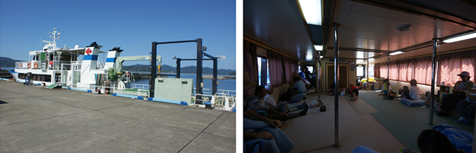
Yorojima Island route : Koniya port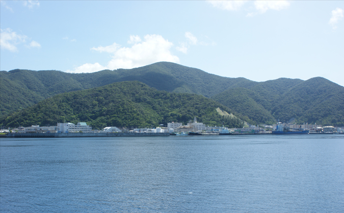
Yorojima Island route : Kakeroma Island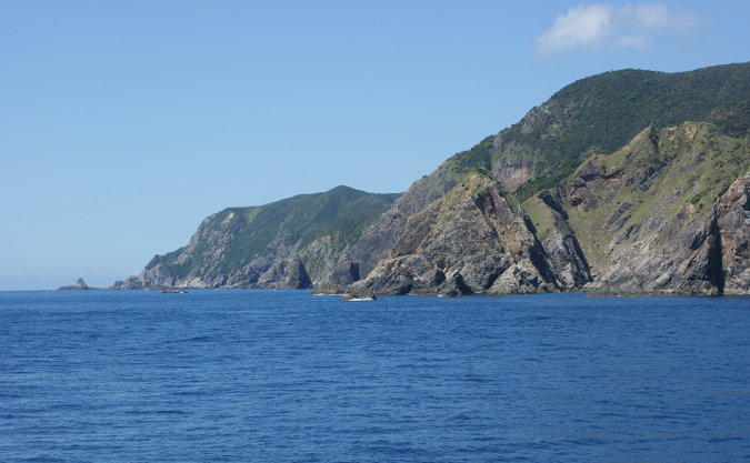
Yorojima Island route : Ukejima Island and Tokunoshima Island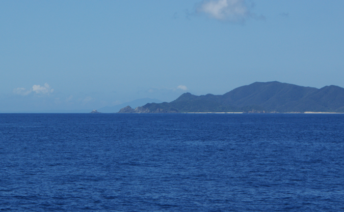
Yorojima Island route : Ukejima Island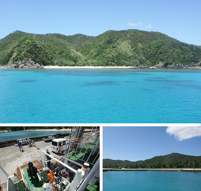
Yorojima Island route : Hanmyajima Island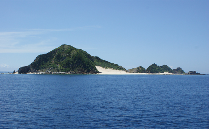
Yorojima Island route : Yorojima Island 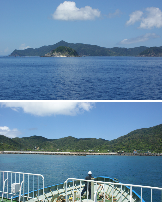
Photo by Daigo Ishii